The atmosphere and oceans significantly impact the biosphere, which is the thin layer of life on Earth that is closely connected to the atmosphere and hydrosphere. This layer is vital for human societies as it provides nourishment. Therefore, if any part of the biosphere is damaged or restored, it can have regional or global consequences.
Human activities that release greenhouse gases into the atmosphere are causing climate change and ocean acidification. It puts natural ecosystems and the societies that depend on them at risk. The impact of these threats is significant and has become more noticeable in recent years. The planet is already experiencing higher temperatures, and it's expected to continue unless carbon emissions are significantly reduced.
Climate change will have negative consequences for both ecosystems and people. The experts warn that if the planet warms beyond 1.5°C, it will result in harmful impacts such as droughts, floods, heat waves, and sea-level rise. Global net carbon emissions need to be reduced by half within the next 12 years to prevent this.
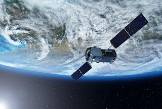
Observing the Earth from space has become crucial in monitoring our planet's environment and climate. Modern types of satellites have powerful sensors that gather extensive data on the Earth's surface, atmosphere, and oceans. This valuable information is utilized to inform environmental policies and aid in developing a deeper understanding of climate change.
Satellites can now measure environmental variables like temperature, precipitation, ocean currents, ice cover, and vegetation. This information can help monitor the health of ecosystems and detect ecological changes caused by humans. Satellites monitor climate change, collecting data for scientists to create future climate models.
Discover the Advantages of Utilizing Earth Observation Satellites for Environmental Monitoring and Climate Research.
Earth observation satellites provide valuable environmental, climate, and natural resources data for policy decisions and sustainable development research. They measure temperature, water vapor, greenhouse gases, ozone, vegetation, soil moisture, and snow cover. Satellites can help to identify areas at risk of hazards like floods and droughts.
This type of satellite is also a reliable tool for health monitoring of oceans by tracking algal blooms, pollutants, and debris. Monitoring the environment and climate is crucial for informed decision-making for safeguarding our planet and its resources. By reducing emissions, protecting species, and ensuring clean air, water, and resources, we can secure a sustainable future for future generations.
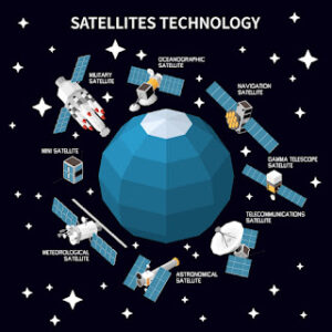
Optical Satellites
Most optical satellites are passive and capture images in the visible or near-visible part of the electromagnetic spectrum. They rely on the sun's radiation reflecting off the Earth and its atmosphere to do so. Optical satellites are cheaper than radar ones but rely on sunlight and have limited nighttime capabilities. They work best with little cloud cover and may require repeated passes to capture images in certain areas.
Although it may seem exaggerated, optical satellite imagery has nearly limitless potential applications.
We can now gain a greater understanding of our planet and universe thanks to satellite technology. Optical satellite images can have a range of valuable applications, including mapping, vegetation monitoring, and coastal monitoring.
Thermal Infrared Satellites
The thermal band is controlled by a dark-body cavity and hot target, transmitting radiance that can be converted to brightness temperatures. The thermal band can help to measure plant heat stress for field analysis. A satellite in a sun-synchronous orbit provides high-res data every two days, with 19 spectral bands.
Radiance data measures LST, water temp, evapotranspiration, water vapor, and material composition. TIR remote sensing data is used in environmental, urban, and land management fields.
Hyperspectral Satellites
Hyperspectral imaging captures images of objects or scenes using visible to infrared light. This advanced imaging method provides detailed information about the object's physical properties and chemical composition. Instead of assigning primary colors of red, blue, and green to each pixel, hyperspectral imaging analyzes the spectrum of each pixel in the image.
Hyperspectral imaging is a helpful tool for analyzing crops. By interpreting the data, one can identify disease, pest infestation, nitrogen, and water levels in the harvest.
Data Integration and Analysis
Satellites are crucial for studying climate change and ecological sustainability. They provide a unique perspective in collecting temperature, precipitation, sea level, and vegetation data. This information helps monitor environmental changes and develop protection strategies for ecosystems.
Satellites can monitor air quality and track changes in land use caused by human activities. This data helps scientists develop strategies to reduce harmful emissions and mitigate negative environmental impacts.
Satellites collect crucial data on climate change and environmental sustainability. They offer a unique perspective for observing global environmental conditions, helping scientists understand the causes and effects of climate change and devise ways to protect the environment.
Although there are difficulties, the satellites' application for observing climate change and ecological sustainability is crucial. With the ongoing impact of global warming, satellites have become a vital resource of information about the environment. By investing in satellite technology, nations can better comprehend the environment's condition and work towards ensuring its sustainability.
Tatiana Vasiltsova is a lifelong eco-activist. Her expertise covers satellite monitoring of natural and man-made landscapes and detection of changes in surface characteristics. Tatyana is a Ph.D. student in information technology and has an impressive list of technical publications.
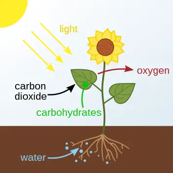
Steps of the carbon cycle process are; photosynthetic assimilation, biomass production, biomass consumption, organic biodegradation, and inorganic carbon release.
Prevention of noise pollution can be achieved through; traffic infrastructural development, remote industrial installation, noise-control regulation, sustainable urban development, and use of good-quality sound systems.